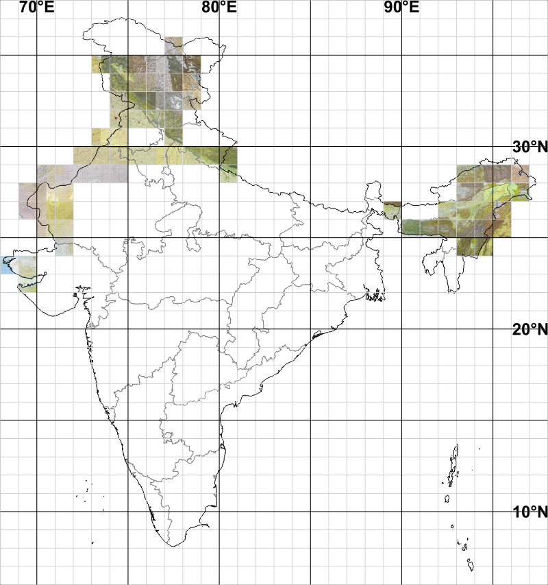
This section has map images of India for use with Deesha created from available scans of US Defence Agency 1:2,50,000 scale Joint Operations Graphic maps (Source: http://www.lib.utexas.edu/maps/jog/india/ [Graphical index] and http://pahar.in/1501-series-maps/).
You can click on the available maps in the index to download a zip file of 1°×1° area containing:
- JPEG file of map image.
- CSV file of map image settings for Deesha.
- KML file with ground/image overlay for Google Earth.
To locate yourself on the index map click here.
Using With Deesha
To use with Deesha:
- Download the ZIP file.
- Extract the contents of ZIP file (one CSV, JPEG and KML file each).
- Copy at least the CSV and JPEG file to 'Deesha' folder created on your device storage.
Note: With newer versions of Deesha you can also create a separate folder within 'Deesha' folder to keep mapimages, say 'maps' or 'mapimages', and copy these file to that folder.
- Start Deesha.
- Open 'Settings' and then 'Map'.
- Enable 'Map Images' if not already enabled.
- Click 'Import Settings'.
- Browse to location of files and select the CSV file to import.
Methodology of Creation
The original images have been made into map images as follows:
- Skew of image adjusted to make the sides (neatlines on map) vertical/horizontal with Photoshop and image cropped to the sides (neatlines).
- Rectified with GlobalMapper (with rectification points at every 30'/0.5° in both vertical/horizontal).
- Individual maps created of 1°×1°.
- Images saved as JPEG with filesize not more than 2MiB with Photoshop.
- Naming of image is:
e.g. '25N_94E_24N_93E_JOG_1966'.
Note
- Users are warned to check the maps for accuracy as maps may be quite old in some cases.
- Elevation Units
- Certain maps have elevation in metres while others have in feet.
- Some maps which are made from combination of 30' (0.5°) horizontal stretch of two maps may have BOTH metres and feet.
- Please check the original map scans which have detailed instruction.
▲